
June 2025 Service Modifications
Updated June 2025-
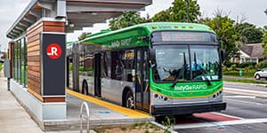
IndyGo’s Route 19 will also experience minor service adjustments to improve on-time performance starting Sunday, June 8. Please review the route page here to plan your trip.
INDIANAPOLIS — On Sunday, June 8, IndyGo will implement schedule adjustments to improve on-time performance and alignment changes to respond to infrastructure projects. The most significant change will be along Michigan and New York streets when they start serving two-way traffic in the Near Eastside.
Schedule Changes:
Routes 3, 8, 38, 56, and the Red and Purple lines will undergo minor timing adjustments to improve schedule adherence and accommodate the new infrastructure along Route 3.
Alignment Changes:
Traditionally, Route 3 has taken New York Street eastbound and Michigan Street westbound between College Avenue and Ellenberger Park. Later this summer, the Indianapolis Department of Public Works (DPW) anticipates these streets will open to two-way traffic. When this project is complete, IndyGo will shift Route 3’s service along New York Street to Michigan Street in both directions throughout this stretch. Between the schedule adjustments’ effective date, Sunday, June 8, and the completion of this project, Route 3 will briefly continue to operate its current routing (detour) along New York Street.
To further enhance this project, IndyGo and DPW collaborated to bring new and improved bus stops to Michigan Street for increased quality and accessibility. For updates and details about the two-way conversion, refer to DPW’s website here. (See Route 3 Bus Stop Impacts map below for alignment changes.)
Plan Your Trip:
Riders are encouraged to check the new schedules at the Julia M. Carson Transit Center to ensure they have the most up-to-date information about their routes. Updated print maps are expected to be available at the Carson Transit Center the week of May 26. Riders can also view updated schedules at the bottom of the individual route pages here.
Riders needing assistance planning their trips can visit the Plan Your Trip webpage here or call IndyGo’s Customer Care Center at 317-635-3344.
###

 Track My Bus
Already have your trip planned? Use our new Track My Bus feature to follow your bus in real time.
Go


 Translate This Page

