
Connecting You
to Your City
To sign-up for Blue Line project updates,
please follow the link below.

To sign-up for Blue Line project updates,
please follow the link below.
Riders will benefit from level boarding, fare collection through MyKey+, real-time arrival signage, frequent service and covered stations for weather protection. Beyond transit, the project also brings major infrastructure upgrades to the Washington Street corridor. This includes new street paving, improved sidewalks and pedestrian crossings, and ADA-compliant curb ramps, making the corridor safer and more accessible for all.
Designed specifically to make commuting convenient for passengers — with fast, frequent operation — the Blue Line is poised to provide better access to work, education, healthcare, restaurants, entertainment and shopping. It offers an equitable alternative to driving for people of all ages and serves as a cornerstone of transportation options for Indianapolis and central Indiana.
The Blue Line is the next stage of our BRT system, providing increased frequency, reliability, comfort and convenience at a fraction of the cost of light rail. But unlike far-spaced light rail, the permanence of BRT infrastructure along the corridor supports increased private investment, contributing to increased economic opportunity and quality of life.
This is more than transit. The Blue Line is a massive infrastructure project, with more than half of the budget addressing the condition of the roadway, pedestrian facilities and drainage. The Blue Line will follow IndyGo’s current Route 8, along Washington Street from Cumberland west to the Airport. With the Blue Line, local route improvements, and the density of the corridor, the Blue Line will extend the rapid-transit benefits to communities and neighborhoods all along its path.
Stations: 30
Station Spacing: ½ – 1 mile
Distance: 24 miles
Design Complete – September 2024
Groundbreaking – February 2025
Construction Begins – Q2 of 2025
Blue Line Opens – Late 2028

Mon – Fri
5 a.m. – 1 a.m.
Sat
6 a.m. – 1 a.m.
Sun
7 a.m. – 10 p.m.
This interactive map shows 100% design for the Blue Line, showing proposed station locations and lane configurations. To view street descriptions and landmarks in the map below, hover over the “satellite” button and check the “labels” box.
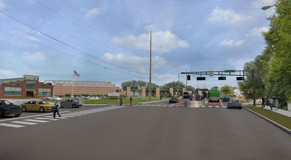
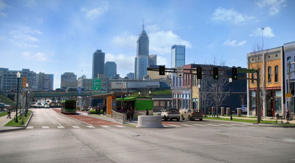
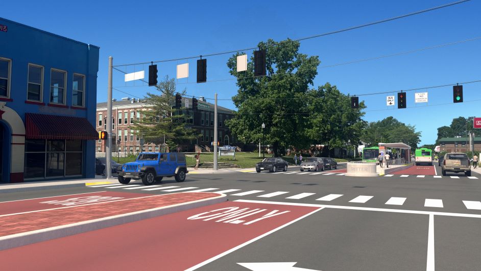
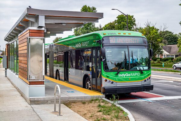
The Blue Line will increase convenience, frequency and reliability, while improving travel times and decreasing wait times.
The 60-foot articulated, clean diesel Blue Line vehicles work seamlessly with rapid transit operation on IndyGo’s BRT lines, with doors opening on either side of the bus.
Instead of bike racks on the front of the bus, Blue Line buses have onboard bicycle storage, meaning those with a bicycle should board at the door nearest the bike storage area. New level boarding platforms allow you to roll your bicycle on and off with ease.
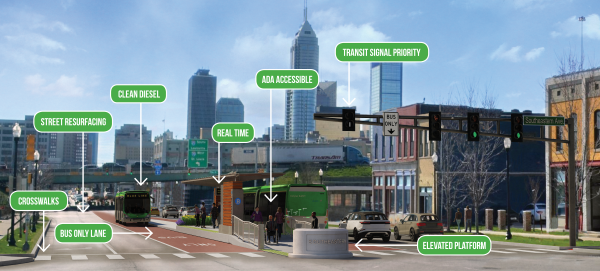
IndyGo reimagined the conventional “bus stop” with specific attention to making the experience convenient for passengers and ensuring fast and frequent operation. The Blue Line’s new rapid transit stations feature:

A Blue Line bus will arrive at each station approximately every 15-20 minutes during peak service. All stations involved with the project will be exclusive to this route.
Features such as transit-only lanes and signal priority at busy intersections allow the Blue Line to maintain its speed and frequency when other vehicles are being delayed by congestion or traffic incidents.
Riding the Blue Line is a more efficient, more convenient IndyGo experience — with a rapid transit emphasis on “go.”
Nearly all the neighborhoods along the Blue Line corridor were once served by streetcars and/or the interurban, and the urban form of these neighborhoods were influenced — and often driven by — these transportation modes. The Blue Line replicates this service. Connecting the City of Cumberland, Downtown Indy and the Indianapolis International Airport will help bring the community together and return it to the bustling, thriving days of the past.
Aside from transit travel time and safety improvements, the Blue Line is a massive infrastructure project, with more than half of the budget addressing the condition of the roadway, traffic safety, pedestrian facilities and stormwater drainage.
Transit riders start and end every trip as pedestrians. The Blue Line project includes sidewalk construction and improvements, upgraded curb ramps, new crosswalks and traffic and pedestrian signals.
Because the project runs along city streets, Indianapolis also benefits from the planned improvements, including:
Find all the resources you need by signing up for the Blue Line newsletter. From project progress and detours to special promotions, you’ll get all the latest insider scoop.
Sign up to receive a construction look-ahead, updated routes and special promotions directly to your email. Submit your email address by clicking below.