Project Overview
The Purple Line is but one component of the larger Marion County Transit Plan that will improve 70% of the entire IndyGo system.
The 15.2 mile Purple Line will connect the City of Indianapolis and the City of Lawrence.
For much of the corridor, the Purple Line will replace and improve our existing Route 39 local service, one of the highest ridership and most productive routes in the IndyGo system. Additionally, this corridor will allow for infrastructure improvements such as sidewalks, roadways, driveways, signals, and drainage.
This frequent, fast, and reliable service will be a core operational component of an entire system of routes that are being maximized for efficiency and easy connectivity.
File Archive
Welcome to IndyGo’s curated archive of documents related to the Purple Line project, such as traffic and environmental studies. As the project has evolved over time, so have the documents associated with it, so please note that several documents may have been updated multiple times. Each document should indicate the date of those changes and/or additions and reflect when they became effective.
Purple Line Presentations
- Purple Line Presentation: August 2020
- Purple Line Presentation: May 2020
- Purple Line Presentation: February 2020
- Purple Line Presentation: Summer 2018
Traffic and Parking Studies
Other Documents
Purple Line Renderings
Community Tools
Business Support
IndyGo works hard to support local businesses before, during, and after Purple Line construction. We have assigned a liaison from our construction management team to be available to stakeholders throughout construction. Jarvis Jointer can be reached at jarvis.jointer@indygo.net or by phone at 317.661.1964 for questions and assistance related to construction activities. Additionally, the Indy Chambers Business Ownership Initiative is available to offer support (including coaching, loans and other tools) to local businesses during construction and can be reached directly at https://indychamber.com/entrepreneurship/.
 Jarvis Jointer
Purple Line Construction Liaison
Jarvis Jointer is an Indianapolis native who earned his Civil Engineering Degree from Purdue University in 2004. He has spent his career in various roles and experiences in Civil Engineering which include Construction Administration, Site Engineering, Transportation Engineering and Environmental Engineering. Jarvis has held Principal roles and lead companies to substantial growth in the local and national marketplace.
As Purple Line Corridor Liaison, Jarvis will serve as a resource to businesses and communities throughout the construction process. For questions or concerns about the project, email jarvis.jointer@indygo.net.
Handouts & Documents
Purple Line Area of Potential Effect Map: The Purple Line has undergone the environmental review process per the National Environmental Policy Act of 1970. This environmental process examines a multitude of variables, such as historical assets and visual quality. The boundaries outlined for examination, both above and below ground, are known as the Area of Potential Effect (APE). This map is available here. Concurrence on the Purple Line’s Documented Categorical Exclusion from the Indiana State Historic Preservation Office (SHPO) and the Federal Transit Administration (FTA) was received on February 22, 2019.
Why are we building the Purple Line?
The Purple Line will provide access to work, education, health care, restaurants, entertainment, and shopping. It will be a cornerstone of a comprehensive set of transportation options serving Indianapolis and central Indiana and will offer an alternative to using autos for people of all ages.
The Purple Line will follow IndyGo’s current Route 39 — one of IndyGo’s highest ridership route. Together with the Red Line, local route improvements, and the density of the corridor, the Purple Line will be an integral component of this regional rapid transit project.
In general, Bus Rapid Transit (BRT) systems provide many of the benefits of light rail at a fraction of the cost. BRT systems provide increased frequency, reliability, comfort, and convenience relative to local bus services. The permanence of BRT infrastructure supports increased private investment in the corridor, contributing to increased economic opportunity and quality of life.
How much will the construction of the Purple Line cost?
Construction of the Purple Line has an estimated budget of $162M.
How is the Purple Line’s construction being paid for?
IndyGo has applied for a competitive Small Starts grant for 50% of costs. However, should the federal Small Starts grant not be available, the project will move forward with local funding from the approved transit income tax. Our estimated budget for the project is $162.4 million.
How will the Purple Line’s operating expenses be paid for?
Purple Line operations will be funded through IndyGo’s annual operations budget. IndyGo’s operational budget is derived from several sources, including federal formula funds, the Indiana Public Mass Transportation Fund, several sources of local funds, fare revenue, advertising revenue, and other sources of earned revenue.
Current Ridership
Segments of routes 4, 38, and 39 currently overlap to comprise portions of the Purple Line corridor.
Fare Collection
The Purple Line will operate under the same fare structure as local IndyGo service. MyKey, IndyGo’s updated fare system, will provide off-board fare payment and collection at ticket vending machines and validators at each station. Additionally, riders will be able to use their mobile app or reloadable card to pay and board rapid transit.
Fare Enforcement
Like the Red Line, the Purple Line will utilize a “proof of payment” system for fare collection, where fares will be paid at ticket-vending machines on the station platform, through a mobile app, or some other form of fare media. To ensure compliance with the fare policy, IndyGo’s fare inspectors will randomly check passengers for proof of payment.
How will the Purple Line impact local transit service?
The Purple Line is only one element of the Marion County Transit Plan; as such, optimal route alignments are being identified. It is likely that local routes that once traversed the same corridor as the Purple Line will now feed into the Purple Line, providing the potential for more frequent service in those areas.
Local routes will remain in service during construction of the Purple Line. During this time, there may be service advisories and/or detours to limit conflict with Purple Line construction and other construction activities occurring along the route. IndyGo will communicate impacts to IndyGo customers, commuters, local businesses and the general public.
Service Hours, Schedule, & Frequency
The Purple Line is planned to be operational from 5 a.m. to 1 a.m. on weekdays and will expand later into the night on weekends, compared to the existing Route 39. The Purple Line will operate every day of every week, 365 days a year.
A Purple Line rapid transit vehicle is projected to arrive at each station every 10 minutes during peak service, and on an adjusted schedule during non-peak times.
Buses/Bus Specifications
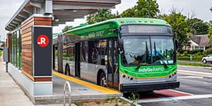
The Purple Line will utilize rapid transit vehicles developed specifically for operation on IndyGo’s BRT lines. The rapid transit vehicles will be 60’ articulated buses with doors opening on either side of the vehicle. The rapid transit vehicles will be fully electric.
Bicycle Infrastructure
Rapid transit vehicles will provide two spaces for onboard bicycle storage. Bicyclists will board at the designated door near the bicycle storage, and platform-level boarding will enable bicyclists to easily roll their bikes on and off each rapid transit vehicle. There will be no bike rack for bicycle storage on the front of the BRT buses.
Of additional note to bicyclists, revisions to the Purple Line design now include a multi-use path along the north side of 38th Street between Tacoma Ave and Sheridan Ave.
Dedicated Lanes
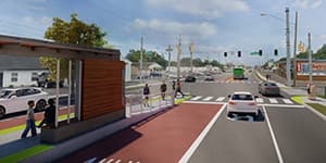
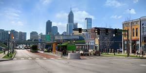
To ensure the Purple Line remains able to maintain its speed and frequency, eliminate impacts caused by motorist interaction, and improve safety for all users in all modes of transportation along the corridor, the Purple Line will operate in dedicated lanes for 90% of the route. Dedicated lanes will be striped and marked “Bus Only,” and in some cases, these lanes may be painted bright red to distinguish them from regular car lanes. Emergency vehicles will also be able to use the dedicated lanes during emergency runs, allowing them to bypass general traffic to reach emergency scenes more quickly.
Electrical Charging Infrastructure
Infrastructure will be installed to accommodate electric charging for the battery electric buses at the last station along the Purple Line, the Lawrence Terminus. The wireless charging (similar to wireless charging for smart phones) will allow for approximately 10-20 minute charges at the end of the route.
Median and Center Gutter
The Purple Line project proposes a unique concrete center gutter that serves as drainage infrastructure along a majority of 38th Street. This center gutter reduces project cost and timeline by avoiding costly utility relocation underneath the north club line along 38th Street. In addition to improving drainage along 38th Street, the center gutter will be embedded into the street and will also serve as a deterrent to making illegal left-turns and U-turns across the bus lanes. To compensate for reduced direct access to the driveways of residences and businesses, U-turns will be permitted at signalized intersections with a protected left turn phased into the traffic signal cycle. To minimize inconvenience and improve safety, traffic signals will be added at five locations along 38th Street to permit left turns, U-turns, and pedestrian crossings.
Stations
The inspiration for the Purple Line station was established through a design competition that took place in the summer of 2016 (more info here). After a public vote and a juried review by a panel of local experts and community representatives, Sean Morrissey’s design was selected as the winner. IndyGo’s design consultants have worked to adapt Morrisey’s concept into a final functional design for actual construction.
The stations will be designed with specific attention to making the Purple Line convenient for passengers and ensuring fast and frequent operation. Lessons learned from the Red Line station design will be incorporated into the Purple Line stations, however, the overall look and feel of that stations will remain the same.
Canopy Roof. The canopy structure has been inverted from the original design to help control the flow of rainwater and to provide a more comfortable boarding process.
Lighting. Lighting will be positioned to provide a well-lit, secure boarding area while minimizing impacts to adjacent properties.
Real Time Arrival Information. Each station will be equipped with a digital marquee sign showing real time arrival information for the next rapid transit vehicle.
Security. In addition to being well lit, stations will incorporate security cameras and emergency “blue-light” phones for reporting emergencies.
Ticket-Vending Machines. Each station will be equipped with ticket-vending machines for passengers to purchase fares prior to boarding the rapid transit vehicle, providing additional convenience, shortening the boarding process, and ensuring consistent operations of the rapid transit vehicle. These machines will accommodate cash and credit/debit card transactions.
The Purple Line will utilize a “proof of payment” system for fare collection, where fares will be paid at ticket-vending machines on the station platform, through a mobile app, or some other form of fare media. To ensure compliance with the fare policy, IndyGo’s fare inspectors will randomly check passengers for proof of payment.
Windscreens. The stations will include windscreens to protect passengers from inclement weather while waiting for the next bus.
Businesses
The IndyGo team is committed to working with local businesses and property owners to minimize the impact that construction has on businesses.
During construction, the IndyGo team will also seek to minimize the time that any one place is under construction by completing all construction activities in one location before moving on to other locations. The IndyGo team will also work with neighborhoods and local businesses to ensure there is adequate signage to show how to access businesses during construction.
Businesses with concerns can always reach out to our team here.
Research suggests that communities with fixed route transit have lower unemployment rates, lower rates of employee turnover, and higher labor force participation. For individual businesses, access to transit promotes a deepening of the labor pool from which they are able to draw qualified employees. For individual businesses, the long-term benefits of proximity to new BRT services has not been widely studied; the number of variables related to those individual businesses, their financial health before the BRT service, and other factors make it difficult to project potential benefits or impacts to any single business.
Environmental
BRT provides positive benefits for the environment. Research shows that commuters can save hours of travel time by shifting to BRT. Reducing both the hours they sit in idling vehicles and vehicle-miles traveled. BRT also translates into better local air quality and reduces the likelihood of road fatalities and crashes. (More information is available here.)
By using electric rapid transit vehicles, IndyGo reduces its consumption of diesel fuel and the resulting emissions. In addition, zero-emission, fully-electric buses produce little to no noise pollution, allowing the rapid transit vehicles to operate without impacting nearby people or activities. It is anticipated that at least some of the daily energy required to charge the rapid transit vehicles will be derived from the solar panels atop IndyGo’s facility.
Archaeology Findings
As part of the National Environmental Policy Act (NEPA), IndyGo engaged in site investigations to determine what, if any, historically significant archaeological resources were within the Project area.
After engaging in site investigations, IndyGo’s team found one significant archaeological find—a small station house foundation located at 38th and Arthington Steet. Remnants of a railbed and pieces of stone and concrete bridge that were once railroad tracks were found at this particular location. Learn more about this particular archeological find here.
Neighborhoods
Neighborhood character and context
Nearly all the neighborhoods along the Purple Line corridor were once served by streetcars and/or the interurban, and the urban form of these neighborhoods were influenced — and often driven by these transportation modes. The Purple Line replicates this service.
Investment and economic impact
The increase in transit capacity can also support an increase in investment and employment within the corridor. The Cleveland HealthLine stimulated $5.5 billion in investment after its opening in 2008. Several studies have found that the implementation of a BRT system leads to an increase in the number of jobs within the transit corridor, as well.
Impact on crime
Increasing transit capacity and frequency has not been found to increase criminal activity. Further, the introduction of well-lit stations with security cameras and other security systems can result in a safer pedestrian environment. Some studies have shown a decrease in criminal activity following the introduction of increased transit service. Research is available here and here.
Sidewalks and Connectivity
As part of the Purple Line, infrastructure improvements will be made at Eva Talley Park including a 10’-wide asphalt multi-use path through the park (north side of 38th Street from Tacoma Avenue to Sheridan Avenue) and a 31’-long by 6’-wide sidewalk connecting the path to the park’s pavilion. At the request of Indy Parks, the park’s name stone will be relocated within park boundaries.
Section 4(f) of the Department of Transportation Act of 1966 provides special protection and requires the opportunity for public input when transportation projects may impact park or recreation resources. FTA made a determination that the Purple Line will have a de minimis impact on the park (impacts to the park are minor in nature).
The proposed site plan for Eva Talley Park may be viewed here.
Parking
The impact on adjacent street parking will vary throughout the corridor. During construction, there may be temporary parking restrictions. IndyGo will work with its construction management team to minimize these restrictions as much as possible.
Property Owners
Research suggests that proximity to a Rapid Transit service increases the values of nearby properties. A sample of this research includes Bowes and Ihlanfeldt (2001); Baum-Snow and Kahn (2000); Garrett (2004), and Hess and Almeida (2007).
Traffic
During Construction. The Purple Line team is in the process of finalizing the overall construction schedule and sequencing plan. As various segments along the corridor are under construction, we will work with our construction management team and contractors to minimize the length of time any single area is under construction. There will be a short duration (10-14 days) of full closures, and long duration (100-130 days) directional closures on 38th Street. Additionally, there may be lane closures that affect vehicular traffic throughout the corridor.
Purple Line activities will be aligned with other projects to minimize additional impacts on traffic during construction. As detour routes are developed, they will be posted online, shared through traditional media, and distributed to community groups throughout the impacted areas.
Traffic Following Construction. Traffic modeling shows that the Purple Line will not result in lower levels of service than what is commonly recognized as an acceptable level (Level of Service D for urban streets). Where traffic already operates below an acceptable level, traffic congestion is not expected to become worse than it is current conditions.
Left Turns and U-Turns with BRT. To maintain traffic flow, on-time transit service and pedestrian and driver-safety, many segments of IndyGo’s Red Line, and upcoming Purple and Blue BRT Lines will operate in exclusive or semi-exclusive center-running lanes. This means that the lanes are only used by rapid transit vehicles and emergency vehicles.
Non-BRT traffic will only be permitted to turn at signalized intersections for their safety. All signalized intersections will include a protected U-Turn phase and the project includes the new signals to improve safety and flow. See video below:
Transit Riders
During Construction. There will be impacts to the IndyGo routes that intersect or operate on 38th Street. Detours and stop closures will be communicated as soon as possible to our riders.
Following Construction. When the BRT system replaces local service on one of IndyGo’s busiest corridor, current transit riders will benefit from increased convenience, frequency, and reliability. In addition, transferring from local route service to the Purple Line will reduce boarding wait times and travel times.
After implementation, BRT riders will have improved, more-frequent access to additional jobs, major hospitals, three institutions of higher education, cultural and community assets, and several neighborhoods.
Will the Purple Line impact my property?
Most of the infrastructure being built for the Purple Line will be within the existing Right of Way (ROW). However, the addition of sidewalks and curb ramps where none currently exist along 38th Street require IndyGo to purchase property up to15 feet off the edge of the road to allow for a new sidewalk or trail, and grass buffer. In addition, some temporary property acquisitions will be required in select locations for proper grading from the new sidewalk to the adjacent property.
Project plans are available on the interactive map and show areas that will require ROW widening.
Will the Purple Line require the removal of any structures?
No. Most of the land acquisition for the Purple Line will be limited to strips of land adjacent to the street for sidewalks and curb ramps, or for widening an intersection to create turn lanes.
How does the property acquisition process work?
The public input process is designed to review preliminary recommendations with the public and stakeholders and mitigate negative impacts through design changes. By the 60% design milestone, project plans will begin to solidify and IndyGo will contract with a third party for property acquisition. The process for property acquisition required for transportation projects is strictly governed by federal regulations and state law. Details of the affected property owner’s rights will be included with the acquisition offer.
Property Acquisition Process:
- Property owner is notified by mail that the property is being appraised.
- The property owner will receive an acquisition offer at the fair market value as determined by the appraisal— and will have 30 days to respond to that offer.
- The property owner can accept, reject, or negotiate the offer.
- If an agreement cannot be met, IndyGo may file suit to acquire the necessary right of way. This step would trigger eminent domain proceedings that would include an additional appraisal by court-appointed appraisers.
What is eminent domain?
Eminent domain is a process that permits certain public agencies to acquire private property for public use through court proceedings, with payment of fair and just compensation as determined by the court-appointed appraisers.
How does eminent domain work?
Eminent domain proceeding is a last resort action to be exercised if a mutually agreeable fair market value cannot be reached. If IndyGo and the property owner cannot come to an agreement on the value of the property to be acquired, the court will appoint appraisers to re-appraise the acquisition property and prepare a report of their determination of the fair and just compensation due the affected property owner. Both the affected property owner and IndyGo have the right to appeal the court appraisers’ determination.
Construction Updates
Interactive Construction Map
Once construction begins, a map will be added to the website here. You’ll be able to use this map by scrolling and clicking on the construction icons to understand what is happening in a particular place.

Weekly Updates
Once construction begins you’ll be able to find weekly updates here relating to what is being worked on and where. Information will also include traffic alerts and detours for motorists, IndyGo riders, cyclists, and pedestrians.
Interested in bid opportunities with IndyGo?
Please visit the main bid opportunities page on the IndyGo website for more information.
Board Actions
- Consideration and Approval for Purple Line 30-percent
- Consideration and Approval for Purple Line Task Order 5 – March 2018
- Consideration and Approval of Purple Line NEPA and Design – March 2017
- Consideration and Approval of Resolution for Purple Line Small Starts – August 2017
- Consideration and Approval of Task Order for Purple Line 30-percent Design and Environmental
